A proprietary system of Seismograph Service Corporation of Tulsa, Oklahoma (a/k/a Seiscor), it was deployed in the Gulf of Mexico for the oil industry. Militarized transmitters and receivers were furnished for use by the Navy.
Lorac was used aboard USNS Michelson during summer 1964's extended sea trials in the Bahamas. An existing chain of shoreside transmitters identified as red, green and center together with a reference station furnished the signals.

A commercial version lorac indicator unit c.
1955. The circular dials are phasemeters.
Mechanical counters kept track of the lane count.
Mechanical counters kept track of the lane count.
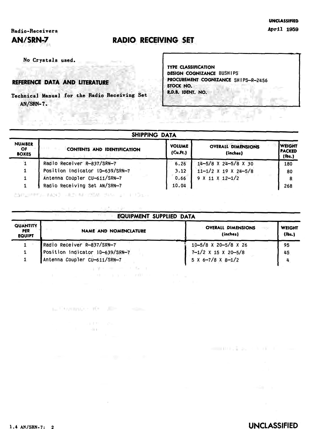
Here are technical details of two military grade Lorac receivers used by the US Navy. In addition to the receiver unit and antenna coupler a position indicator furnished time/phase difference readings on two dials. Mechanical counters kept track of lane count. Lorac had no lane identification feature.